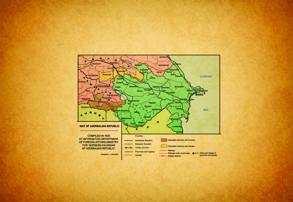
Aghdam district – administrative district in the Republic of Azerbaijan. Established in 1930. Situated in northern-east foots of Karabakh range and southern-west of Kuras-Aras plain. Area is 1150 km², population is 167,3 thousands of people (01.01.2006). Center is Aghdam town.
The district is consisted of Aghdam town and Shotlanly, Shelly, Poladly, Shikhbabaly, Mughanly, Papravand, Garapirimly, Sarijaly, Gullar, Garadaghly, Gulably, Abdal, Novruzlu, Kangarly, Shirvanly, Garagashly, Yusifjanly, Goytapa, Javahirly, Kosalilar, Abdinly, Sirkhavand, Garashlar, Boshirlar, Malikly, Bash Guneypaya, Yeni Garalar, Khatinbayli, Sarijaly, Dadashly, Hasankhanly, Kokaltma Birliyi, Gazanchy, Acharly, Guzanly, Imamgulubayly, Chully, Eyvazly, Uchoghlan, Alibayly, Kichikly, Ballar, Baharly, Ortagishlag, Boyukboyly, Garabaghly, Rizalar, Evoghlu, Zangishaly, Mahrizly, Afatly, Hajimammadly, Isalar, Kudurlu, Hajituraly, Gahramanbayly, Mammadbaghirly, Chamanly, Shukuraghaly, Khindiristan, Sarichoban, Pashabayly, Bahary, Baybabalar, Bash Garvand, Orta Garvand, Ayag Garvand, Chiragly, Ahmadaghaly, Mirashally, Kolgishlag, Yusifly, Kablahuseyinly, Giyasly, Keshtazly, Etyemazly, Alimadatly, Aliaghaly, Galaychilar, Khachindarbatly, Mollalar, Kurdlar, Jinly, Magduslu, Eyvazkhanbayly, Shishpapagly, Tarnoyut, Talyshlar, Chullu, Tapamahalla, Shahbulag, Tukazbanly, Salahsamadlar, Khidirly, Ahmadavar, Chukhurmahla, Gulluja, Ilkhichilar, Suma, Taghibayli, Boyahmadly, Gizil Kangarly, Salahly Kangarly, Sofulu, Baghbanlar, Saybaly, Ismayilbayly, Mughanly, Pirzadly, Shikhlar, Namirly, Tazakand, Manikly, and Marzily villages.
Relief of Aghdam district is mainly plain, partly mountainous. Antropogen and Neogen sediments in plain areas and Tabashir and Yura sediments in mountainous part are apparent. There are limestone and other deposits (sement raw material, gravel, and sand) in the district. Climate is mainly mild-hot, dry-subtropical. Average temperature is between -0,2°C and 1,8°C in January, and between 23°C and 26°C in July. Annual rainfall is 300-550 mm. Khachin and Gargar rivers flow through the territory of the district. Chestnut colored and bright chestnut colored, mountinous dark chestnut colored and brown mountin-forest soils are spreaded. Plants are generally are types of bush, dry steppe, and semi-desert (wormwood, salsola and etc).
Animals: jackal, wolf, fox and etc.
Birds: partidge, turaj and etc. There are a lot of rodents.
Grain growing, grape growing, cotton-growing, cattle-breeding and silkworm-breeding developed in Aghdam district.
There are 148 high schools, music shools, 24 clubs, dram theatre, mugham school, bread museum, picture gallery, history museum and 69 medical points in the district. Home-museum of Gurban Pirimov is also there.
Gutlu Musa ogly tomb (1314 m) in Khachindorbotly village and tomb in Kangarly village (14 centuries) are monuments of the district. There are 2 tombs of 18th century, mosque and etc. in Papravand village.
On Julye 23, 1993 the district was occupied by Armenian armed forces.
Azerbaijan National Encyclopedia. 25 volumes, “Azerbaijan” volume, Baku, 2007, pg.851




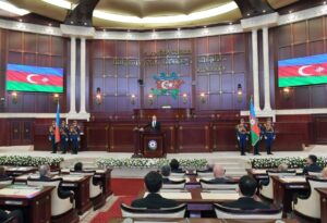 Inauguration ceremony of President of Azerbaijan Ilham Aliyev was held
 Ilham Aliyev wins presidential election with 92.05 percent of votes VIDEO
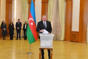 President Ilham Aliyev, First Lady Mehriban Aliyeva and family members voted in Khankendi VIDEO
 Plenary session of 6th Summit of Conference on Interaction and Confidence Building Measures in Asia gets underway in Astana. President Ilham Aliyev attends the plenary session VIDEO
 President Ilham Aliyev was interviewed by Azerbaijani TV channels in Prague VIDEO


