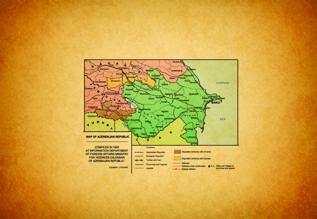
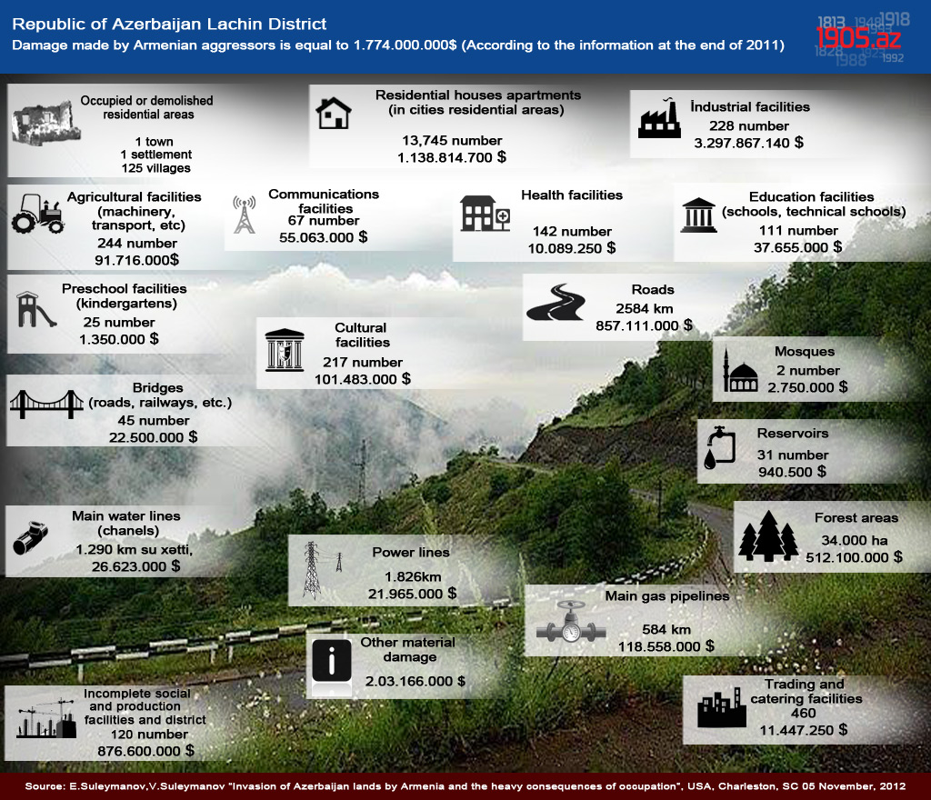
Kalbajar district – administrative district in the Republic of Azerbaijan. Established in 1930. Situated in the central part of the Lesser Caucasus. It is bordered with the Republic of Armenia in the west. Area is 3054 km², population is 73, 6 thousands of people (01.01.2006). Center is Kalbajar town.
The district is consisted of Kalbajar town, Istisu settlement, Zivel, Keshdak, Nadirkhanly, Takhtabashy, Hasanriz, Gozlu, Qozlu Korpu, Narinjilar, Charaktar, Lev, Abdullaushagy, Garachanly, Aghyatag, Fatalilar, Mozkand, Aghdaban, Chaygovushan, Aghjakand, Orujlu, Zaghalar, Tazakand, Yenikand, Ali Bayramly, Vazirkhana, Almalig, Lachyn, Asrik, Choban, Karahmaz, Chorman, Ashagy Ayrim, Yukhary Ayrim, Boyagly, Baghlipaya, Alirzalar, Shahkaram, Chovdar, Dalgilichly, Otagly, Daragishlag, Barmagbina, Otgishlag, Damirchidam, Ganlikand, Zar, Vang, Yellija, Alolar, Kaha, Hasanlar, Armudlu, Takdam, Zaylik, Hopurlu, Sheyinly, Zulfugarly, Garaguney, Kechiligaya, Istibulag, Goydara, Aghdash, Gamishly, Baghirsag, Jomard, Garaguney, Najafalilar, Pirilar, Kilsaly, Alchaly, Marjimak, Aghgaya, Chopurlu, Birinji Milly, Ikinji Milly, Uchunju Milly, Gunashly, Allikand, Boyur, Alchaly, Orta Garashanly, Bash Garashanly, Imambinasi, Kholazay Alkhasy, Saridash, Guneypaya, Seyidlar, Jamilly, Susuzlug, Gasimbinasy, Sinig Kilsa, Bashkand, Tirkashavand, Zargula, Gazhikhanly, Galaboyun, Garakhanjally, Chaykand, Kandyeri, Kilsa, Ashaghy Khach, Mishni, Chaply, Elyasalilar, Orta Shurtan, Yukhary Shurtan, Soyugbulag, Takagaya, Babashlar, Bozlu, Chirag, Tovladara, Mammadsafi, Yanshag, Zallar, Yanshagbina, Dovshanly, Bazarkand, Hayad, Gizilgaya, Yukhary Oratagh, Vangly, Chormanly, Shahmansurlu, Heyvaly, Davadashy, Yayijy, Imarat-Garvand, Chapar, Zardakhach, Kolatagh, Damghaly, Childiran, Mehmana villages.
Surface is mountainous (Murovdagh, Shahdagh, Eastern Goycha, Mikhtokan, a piece of Karabakh ranges and Karabakh plateau. The highest summits are Gamish dagh (3724 m) and Dolidagh (3616 m).
Minerals: mercury, gold, mineral waters, building materials and etc. Climate of the district is dry cold and mountainous tundra. Average temperature is between -10°C and -3°C in January, and 5-20°C in July. Annual rainfall is 700-900 mm. The biggest rivers are Tartar ( upper stream) and its branched (Levchay, Tutgunchay and etc). Bazarchay river starts from the territory of the district. There are lakes as well. Central and eastern part of the district are characteristic with broad-leaved forests ( oak, beech, hornbeam), forest-steppe plants.
Animals: rock goat, brown bear, wild boar, blackcock, eagle and etc.
Kalbajar essentially is a district of agriculture. Cattle-breeding, tobacco-cultivation and bee-keeping are well developed. Industrial enprises: Istisu mineral bottling factory, Shorbulag mercury factory.
There are 114 high schools, vocational school, art school, museum, central hospital, polyclinic, children’s hospital, 7 village hospital, 75 medical attendant points, 23 village out-patient’s clinic in the district. As well as, there a several historical and architectural monuments, for example, Albanian temples in the district.
On April 2, 1993 Kalbajar was occupied by Armenian armed forces.
Azerbaijan National Encyclopedia. 25 volumes, “Azerbaijan” volume, Baku, 2007, pg.861






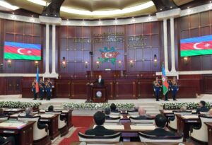 Inauguration ceremony of President of Azerbaijan Ilham Aliyev was held
 Ilham Aliyev wins presidential election with 92.05 percent of votes VIDEO
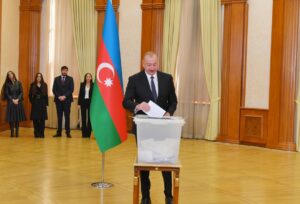 President Ilham Aliyev, First Lady Mehriban Aliyeva and family members voted in Khankendi VIDEO
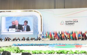 Plenary session of 6th Summit of Conference on Interaction and Confidence Building Measures in Asia gets underway in Astana. President Ilham Aliyev attends the plenary session VIDEO
 President Ilham Aliyev was interviewed by Azerbaijani TV channels in Prague VIDEO


